a morning exploring the black rock canyon area of joshua tree national park. this is a lesser known part of the park & though the campground is usually busy, it’s less packed than the main entrances.
nature photography
rolling sands
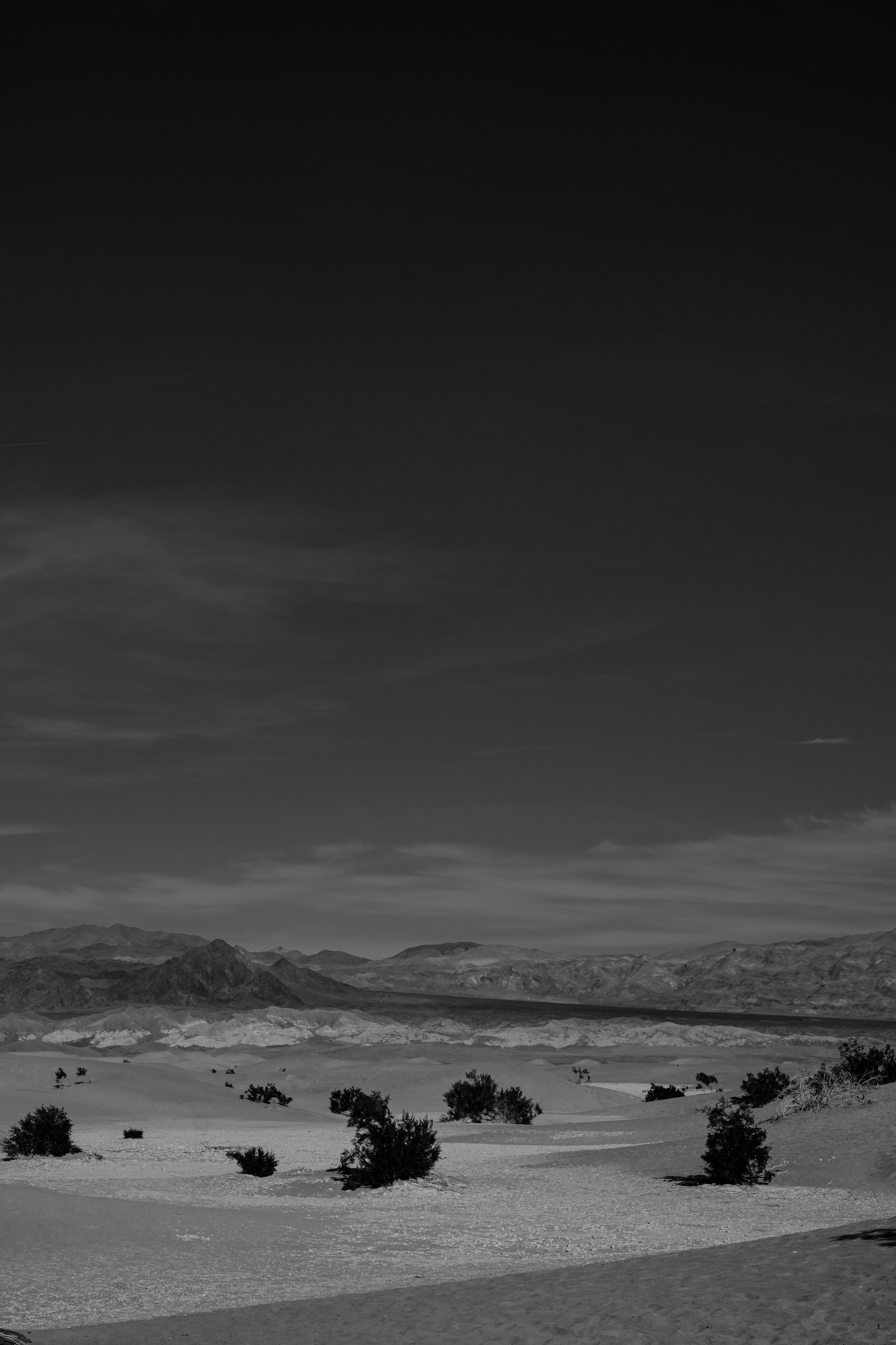
a bright afternoon on the mesquite flat dunes in death valley. I have been playing with photographing the desert in black & white recently. there is just something immortal about the way these came out.
back at the rocks
journal:
woke up at 3am & went to the desert. highway 14 served as a kind of line between the slowly spreading dawn & the thick close smoke of fires burning to the north.
the morning sun doesn’t so much rise here as it does spread out. the light fills the darkness like water saturating a cloth. it blooms. osmosis.
spent a morning a few weeks ago at my favourite state park – red rock canyon in cantil. I’ve taken a lot of photographs of this park over the years so I decided to bring my film cameras out to play.
vasquez rocks
just off highway 14 less than 45 mins from los angeles are vasquez rocks. you may recognise this formation from the movies, they have starred in everything from star trek to blazing saddles to the flintstones. the striking shapes were created by rapid erosion during uplift some 25 million years ago & later revealed by further uplift on the san andreas fault.
what’s uplift? known to geologists as orogeny, this is the primary way mountains are formed on earth. an orogeny occurs where two or more (lithospheric) plates converge when the plate’s motion compresses the margin between them. this pressure forces the earth’s crust to crumble & uplift into the formations you see here. these will eventually (millions of years from now) become mountains.
ongoing tectonic activity on the nearby san andreas fault and its offshoot, the elkhorn fault which runs through the vasquez rocks natural area park, continues to shape, uplift, & expose the buried sandstone.
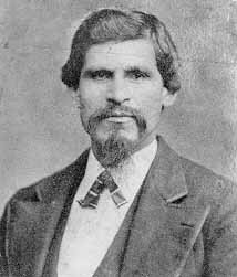
the rocks were named for famous mexican california outlaw tiburcio vasquez who used them to evade law enforcement in 1874. tiburcio was & is a controversial figure, with some believing him a ruthless bandit & others seeing him as a revolutionary opposing the american expansion into present day california.
vasquez entered outlaw life in 1852 when he was witness to the killing of monterey constable william hardmount. though he denied any involvement in the death vasquez fled law enforcement, going on to become a star figure in the infamous decades long roach-belcher feud. after being caught horse rustling in 1856 he spent five years in san quentin before organizing a prison break. in 1866 he was imprisoned again, this time for three years after a burglary in petaluma.
after he was arrested for murder in may 1874 vasquez, who was a charming & handsome figure with many fans throughout the west, sold photographs with & of himself to support his legal defense. he was tried for a murder that occurred four years prior during a robbery in tres pinos (now called paicines) where $2,200 (more that $47,000 in today’s money) was stolen from a store & three were killed. vasquez maintained throughout his trial that though he was an outlaw, he was not the killer. despite his adoring public & a written confession from another member of the gang, he was convicted of the crime & executed by hanging on 19 march 1875 at just 39 years old.
there are numerous geologic formations throughout southern california named for vasquez, including these rocks & robbers roost in kern county. he is buried in the mission cemetery in santa clara where fans still leave him flowers.
because of his affluent background, good looks, education, & sense of style, vasquez is believed to be one of the inspirations for the bandit-hero character zorro.
wind & rocks
a morning walking amongst the rocks & the high winds at red rock canyon state park, ricardo campground.
big valley
big morongo canyon preserve is one of the 10 largest cottonwood & willow riparian habitats in california. managed by the bureau of land management, the reserve is a 31,000 acres. it is located in the transition zone between the mojave desert & the colorado desert.
details
fun facts:
red rock canyon state park is one of the darkest skies within a 2 hour drive of los angeles, making it an excellent place for amateur astronomy.
the tall thin spires of rock which rise from the desert badlands are called “hoodoos”.
the center of the park is an alluvial plain, caused by the depositing of sediment over millions of years by rivers flowing through the area from higher elevations.
valleys throughout the area were caused by simultaneous or concurrent uplift (due to fault-line activity) & erosion.
several films have been shot here, including many westerns & blockbusters like jurassic park.
fossils
inside one of the circular erosions.
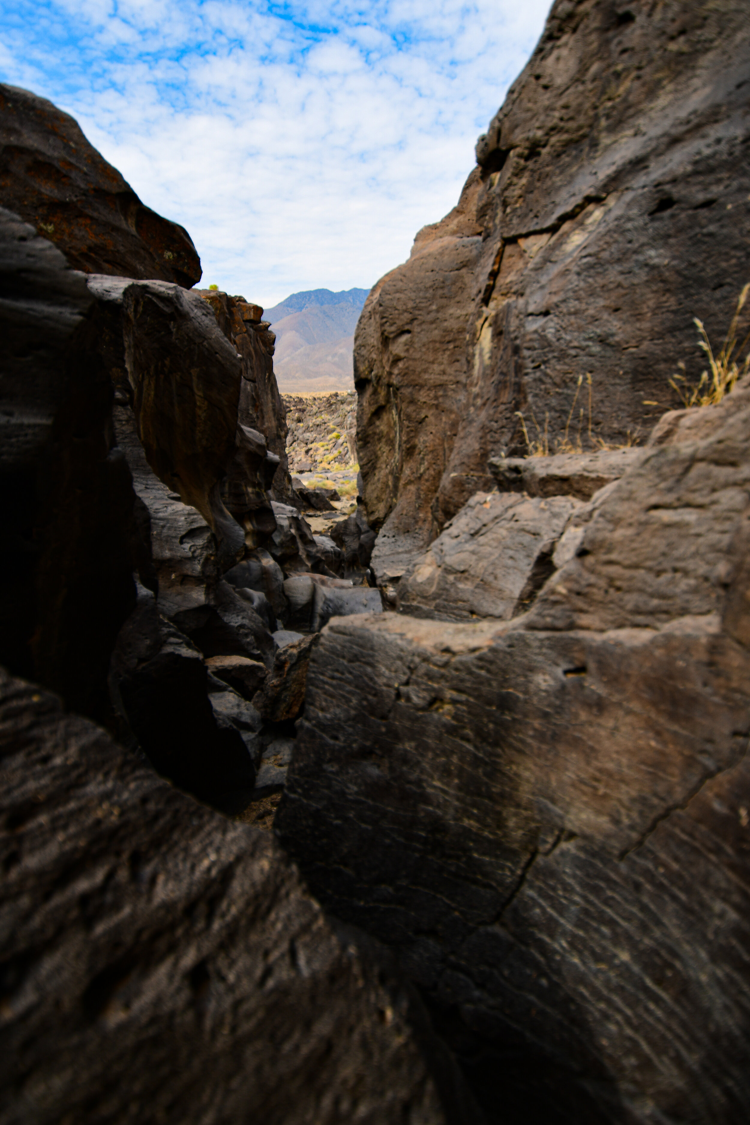
spent an early morning last week climbing around fossil falls off highway 395 in the california desert. I left los angeles at 4 am to beat the heatwave temperatures, but it was still 90+ degrees when I arrived at around 6:30 in the morning.
fossil falls is a fascinating geological feature that contains neither fossils nor waterfalls! tens of thousands of years ago water runoff from nearby glaciers made its way through the valleys of the high desert. there they met with some obstruction from volcanoes! the running water carved volcanic rock into the spectacular tumble that is now fossil falls. the basalt shapes are almost alien looking & feature perfectly circular erosions called potholes where rushing water drove sediment into the rock via rotating eddies.
you might also recognize fossil falls from a short film I shot there a few years ago, finite.
hiking with the devil
the devil’s punchbowl natural area is an LA county park in the transitional zone between the san gabriel mountains & the mojave desert. it surrounds a punchbowl formation, where a millennia of shifts in the plates of the earth along the punchbowl fault have forced a sandstone syncline—where the edges of the earth have been folded upward while the center dropped.
the punchbowl fault connects with the famed san andreas fault only a short distance northward.
the devil’s chair is aptly named!
within the natural area is the devil’s chair, a narrow outcropping of rocks providing panoramic views of the surrounding geology. while the chair & the path immediately to it are lined with a rough metal fence the height, wind, & narrow width had me a bit nervous. the trail itself is frequently about a foot wide & barely cut into the side of the mountain. man-made railings are sporadic & in various states of disrepair. the view is well worth the trek, even though I only sat in the devil’s chair for a few minutes!
my way of reminding myself what I’m taking a photo of.
from several vista points along the trail you can clearly see the line of rock marking faultline activity. after climbing the devil’s chair route, I took the much shorter loop trail down into the canyon to see the sandstone rock formations close up. a stark visible reminder that our planet is always shifting.
the devil’s chair hike is about 7.5 miles out & back, mostly moderate with a couple of steep sections at the beginning & end. limited shade & portions which are not for the faint of heart.
the loop trail is a steep 1 mile circut from the punchbowl natural area’s parking lot down into the canyon where the sandrock creek winds between the stones.
parking is free, but limited.
a tale of two blooms
things found while strolling the hollywood hills in early summer…
joshua tree
joshua tree national park straddles both the colorado desert & the mojave desert in eastern california. the park was originally declared a national monument in 1936 & re-designated a national park in 1994 after congress passed the ‘california desert protection act’. taking up nearly 800,000 acres, the park itself is slightly larger than the state of rhode island. joshua tree is named for its trademark vegetation, the yucca brevifolia, which is native to the mojave desert.
the fire
the fire burns against the water
the fire burns against the sea.
I wake in hills surrounded by kindling
I wake in california breeze.


