explore

old volcano friends

amboy crater rises up almost 1000 feet above its surrounding lava field.

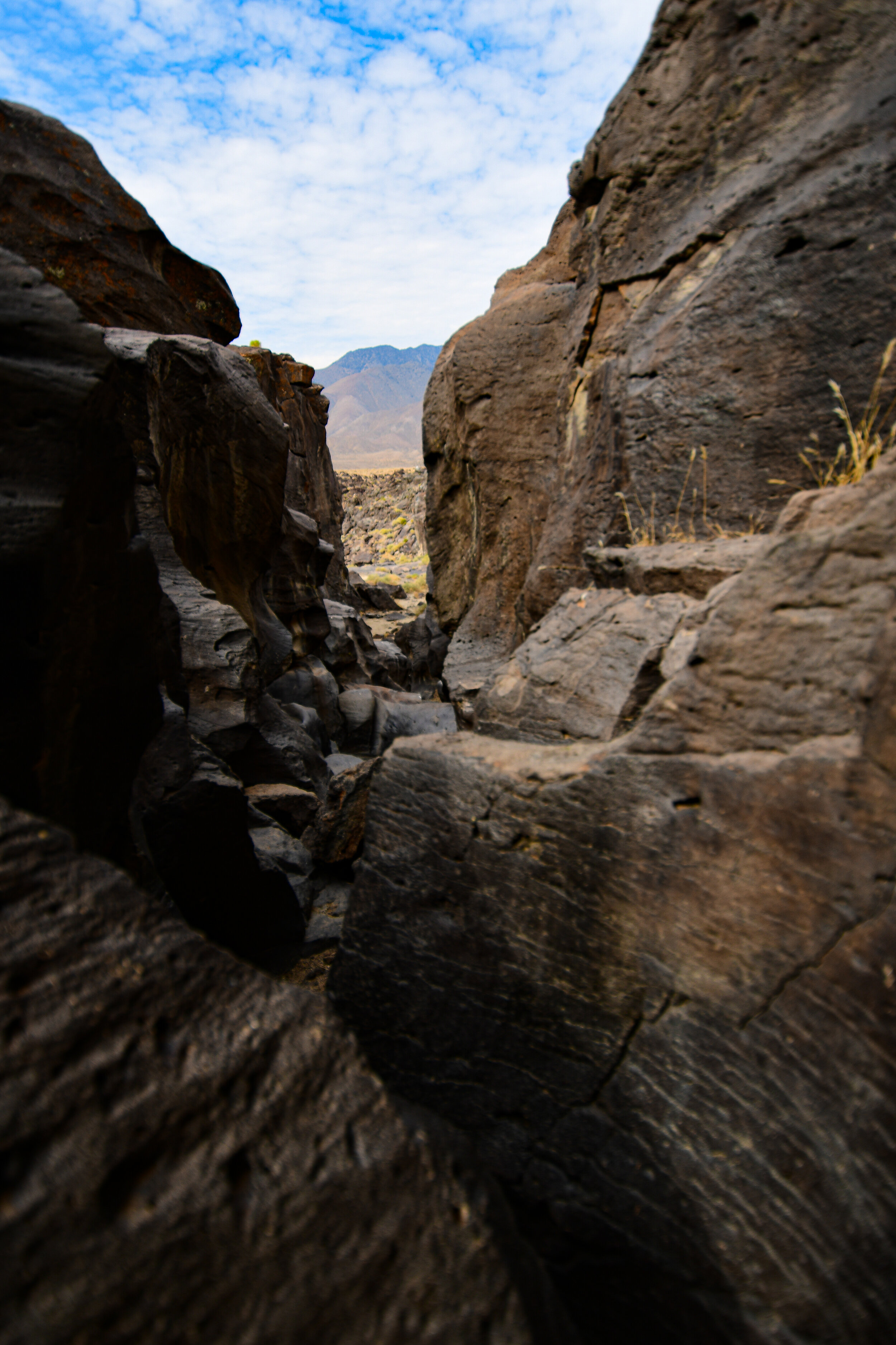
amboy crater is a cinder cone volcano located just off route 66 in california’s mojave desert. a cinder cone volcano is the simplest form or volcano, created when lava & particles are shot into the air during an eruption from a single vent. the cooling lava falls back to the earth creating a cone shape around the vent.

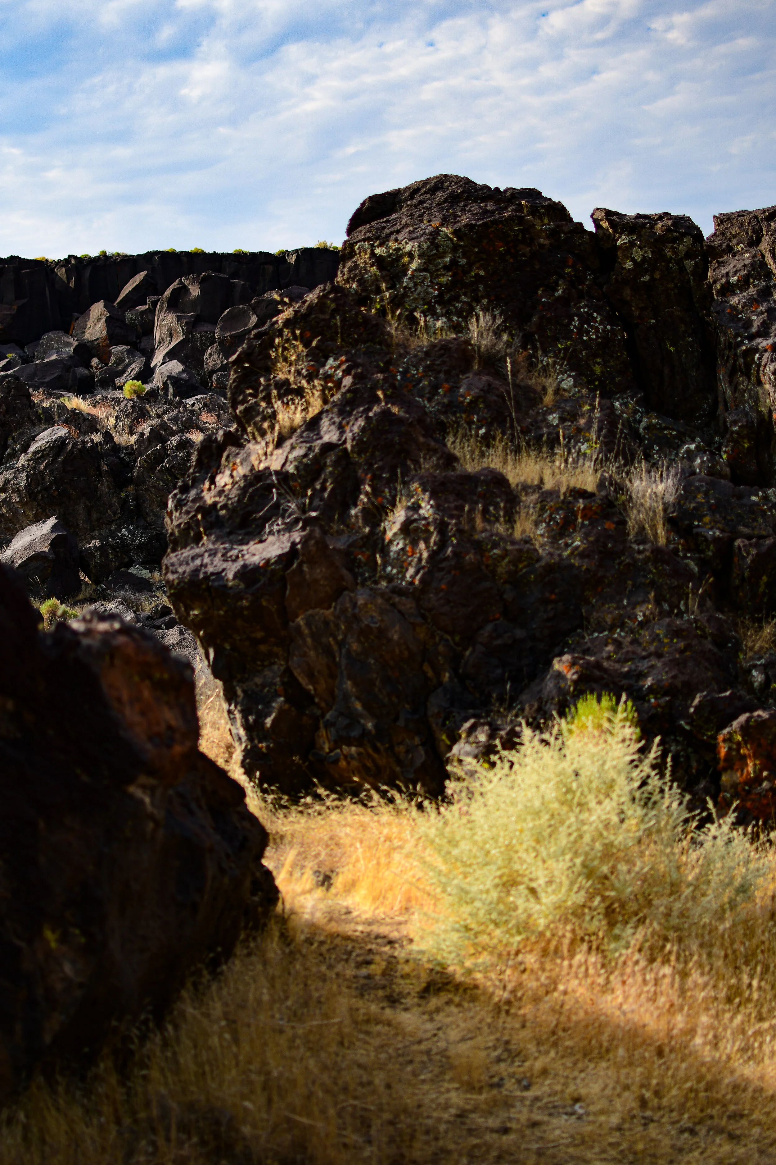
the amboy volcano is considered extinct & hasn’t erupted for at least 10,000 years. an easy 4.1 mile out & back hiking trail takes you through the surrounding lava field & into the crater. temperatures get very hot in the summer, above 100 degrees most days. bring extra water, sunscreen, & sun protective clothes.

view into the crater from the volcano’s rim.

Reds

there are several “red rock” parks throughout the united states. one of the perhaps lesser known ones is red rock canyon state park in southern california just off state highway 14.

bisected by the road, the park is easy to find & provides gorgeous views from even a passing car window. located at the southern most tip of the sierra nevada mountains where they meet with the el paso range, driving through you can clearly see as the desert topography changes around you.

the distinctive red rocks once served as landmarks for passing mule freight teams in the 1870’s & the park land now protects several significant paleontology sites, as well as the remains of late 19th century mining operations.

I left los angeles at 4 am to catch the sunrise over these picturesque natural scupltures. the dawn light made the desert look like a painting. the only word that comes to mind to describe it is “majestic”. it was absolutely gorgeous.

fossils

inside one of the circular erosions.

spent an early morning last week climbing around fossil falls off highway 395 in the california desert. I left los angeles at 4 am to beat the heatwave temperatures, but it was still 90+ degrees when I arrived at around 6:30 in the morning.

fossil falls is a fascinating geological feature that contains neither fossils nor waterfalls! tens of thousands of years ago water runoff from nearby glaciers made its way through the valleys of the high desert. there they met with some obstruction from volcanoes! the running water carved volcanic rock into the spectacular tumble that is now fossil falls. the basalt shapes are almost alien looking & feature perfectly circular erosions called potholes where rushing water drove sediment into the rock via rotating eddies.

you might also recognize fossil falls from a short film I shot there a few years ago, finite.

happy accidents

I went for a wander around one of my favourite places in claifornia—salton sea—a week or so ago. I have been experimenting with a wide angle lens (nikkor 10-24mm f3.5/4.5) with some interesting results. this day I unknowingly left the multiple exposure setting activated & ended up with a few cool double exposed images of the the sea & its surrounding area. love it when accidents help us find something interesting!

hiking with the devil

the devil’s punchbowl natural area is an LA county park in the transitional zone between the san gabriel mountains & the mojave desert. it surrounds a punchbowl formation, where a millennia of shifts in the plates of the earth along the punchbowl fault have forced a sandstone syncline—where the edges of the earth have been folded upward while the center dropped.

the punchbowl fault connects with the famed san andreas fault only a short distance northward.

the devil’s chair is aptly named!

within the natural area is the devil’s chair, a narrow outcropping of rocks providing panoramic views of the surrounding geology. while the chair & the path immediately to it are lined with a rough metal fence the height, wind, & narrow width had me a bit nervous. the trail itself is frequently about a foot wide & barely cut into the side of the mountain. man-made railings are sporadic & in various states of disrepair. the view is well worth the trek, even though I only sat in the devil’s chair for a few minutes!

my way of reminding myself what I’m taking a photo of.


from several vista points along the trail you can clearly see the line of rock marking faultline activity. after climbing the devil’s chair route, I took the much shorter loop trail down into the canyon to see the sandstone rock formations close up. a stark visible reminder that our planet is always shifting.

the devil’s chair hike is about 7.5 miles out & back, mostly moderate with a couple of steep sections at the beginning & end. limited shade & portions which are not for the faint of heart.

the loop trail is a steep 1 mile circut from the punchbowl natural area’s parking lot down into the canyon where the sandrock creek winds between the stones.

parking is free, but limited.

park’s website.

neons

spent a few days last week in my hometown on a rare visit. drove past my elementary school & high school, wandered the old neighbourhoods, & revisited some historic haunts. I’ve always had a thing for interesting & vintage neon signs.

the neon sign for powell villa in outer se portland was likely installed in the late 1950s.

avalon theatre, opened as the sunnyside theatre in 1912. the avalon sign likely dates from 1925.

joshua tree

joshua tree national park straddles both the colorado desert & the mojave desert in eastern california. the park was originally declared a national monument in 1936 & re-designated a national park in 1994 after congress passed the ‘california desert protection act’. taking up nearly 800,000 acres, the park itself is slightly larger than the state of rhode island. joshua tree is named for its trademark vegetation, the yucca brevifolia, which is native to the mojave desert.

more photos.

blooming

I spent the morning a few days ago wandering the California Poppy Reserve, despite almost 35 mile per hour winds! The superbloom happening in Southern California right now, however, was more than worth the chapped lips & wind-whipped hair.

Put together a short video (of very wobbly windy footage) of my explorations. Look for more photos & videos from this gorgeous adventure on my instagram in the coming weeks.

+++

The Antelope Valley California Poppy Reserve in Lancaster, California is home to the most consistent blooming of the state's flower, the California poppy. The department of California State Parks does not water or stimulate the flowers in any way, instead leaving the blooms in their strictly natural state. It is against state law to remove flowers from the site & veering off the established paths can result in a hefty ticket. The traditional blooming season for California Poppies is mid-February through mid-May.

The so-called "superbloom" of 2019 was caused by an increase in rainfall during the winter months in Southern California. Parking on-site at the reserve, which is currently open 7:00am-7:00pm, is $10 per passenger vehicle, or you can opt to park on the shoulder of the road for free, provided you are at least 100 feet away from the park's entrance.

Amoebas

Founded in the 90’s in Berkeley, California, Amoeba Music is the world’s largest independent music chain. The San Francisco location, in the infamous Haight-Ashbury district, occupies over 24,000 square feet inside a former bowling alley. Opened in 2001, the Hollywood location on Cahuenga & Sunset Blvds instantly became a landmark, with its distinctive architecture & entire second floor dedicated to DVDs.

In 2018 Amoeba Hollywood faced eviction, as land owners decided to tear down the store to make way for a slate of luxury high rises after its lease ends in early 2019. The record giant plans to move to a new, albeit smaller, location nearby in Hollywood sometime this year.

Details: Mont Saint Michel

At low tide you can walk all the way around the island of Le Mont Saint Michel in the sticky silt. There are tiny details, from chains & pipes to dead creatures revealed only when the sea is out.

Whitewater, CA

A census-delegated place in California’s Riverside county, Whitewater began as a watering stop for travelers on the Bradshaw Trail between San Bernadino & the Arizona Territory in 1862. Still home to a small population, Whitewater is now known for its trout farm in the Whitewater river canyon.

Due to the effects of recent wildfires, the popular swimming hole in Whitewater river along interstate 10 is closed to the public. But the signs warning of imminent flash flood danger & high penalty fines don’t stop intrepid visitors from jumping in for a refreshing dip.


Dreaming in the Tall Grass

travel diary:

I imagine myself laying in the waist deep grass of the normandy marshlands. it rolls out in every direction until it simply ends on the coast with the creeping high tide. the end is not the hard line the map makes it out to be, but rather it is a place where greenyellow blurs into slowly rolling grey. I watch as my boots slough mud on the trampled blades.

Details - Lock It Up

a love lock is a padlock which lovers attach to a bridge, gate, fence or other monument to symbolize their love. paris' pont des arts bridge is perhaps one of the most famous locations for these locks, though the practice has spread to virtually all of the 12 bridges crossing paris' seine river. 

I had always thought the love lock tradition began in paris, but this is incorrect. the practice was happening earlier in asia & eastern european countries & only moved to the city of light in roughly 2008. 


attaching these locks to public structures is considered vandalism in most countries & the locks are periodically removed by local governments. but you'll still find them en masse on the bridges of paris.